Dimap is offering now upgraded Bathymetric LiDAR (Light Detection and Ranging), which used to measure the depth of water bodies and map underwater features.
Bathymetric LiDAR systems emit laser pulses from an aircraft flying typically below 1500ft. The depth of laser penetration into water depends on factors like water clarity and turbulence. Green lasers of 532 nm measures the time it takes for the laser light to travel from the sensor to the water surface, down to the bottom, and back .
Compared to
traditional survey methods, our Bathymetric LiDAR offers rapid and accurate
data collection over large areas of water depth where boat based methods are
not economic.
Dimap just finished together with partner Ofek Aerial Photography in Israel the yearly mission of mapping the changes on the shores of the Dead Sea – the lowest point on Earth.
This sample which shows the En Gedi area illustrates the decreasing water level and the increasing appearance of sinkholes, forcing changes in routings of the road number 90.
Dimap is back in Perth with an office – after years of operating surveys in Australia from overseas we are back in Perth with an office and permanent staff in our new Subiaco office.
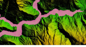
Together with our local partner Geo 3D Modelling, Dimap flew in the last weeks planning data for hydropower projects and the connecting powerlines with an investment volume of more than 2 billion USD. While Nepal is on the way to improving the capacity of hydropower production for its consumption but also exports to India the need for precise surveys in the mountain areas along the Himalayas is huge.
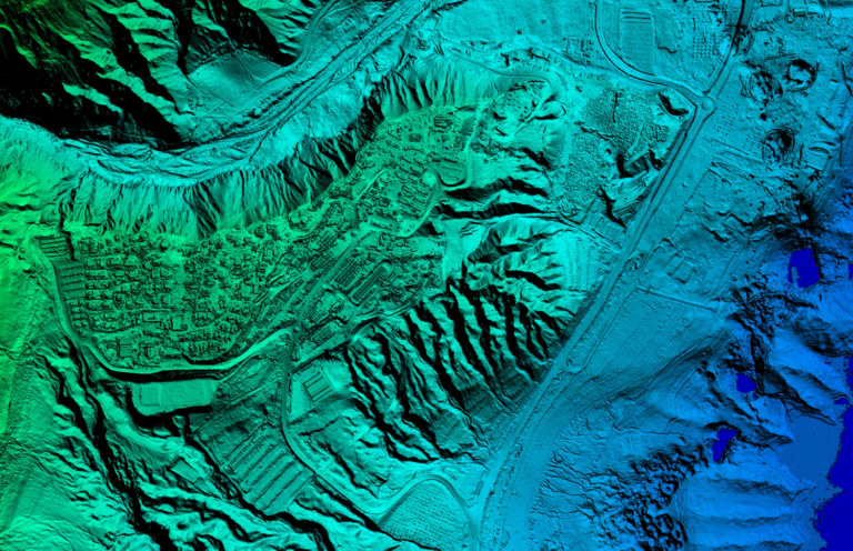
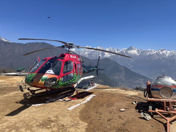
Operating Lidar and image data collection installed in local helicopters allowed Dimap the fast collection of large areas also in difficult terrain with an accuracy better than 6cm absolute. This helps Nepal to develop the potential of hydropower towards 83000 MW identified by international experts.