Using Lidar, Hyperspectral, and Thermal sensors, Dimap recorded and processed a unique data set over a glacier near Santiago. The data allowed for a detailed analysis of the changes in the Glacier conditions
In mid-April 2013 Dimap, conducted a high-altitude aerial survey over Glacier Carlos, south-east of Santiago, using Lidar, VNIR hyperspectral (400 to 1000nm wavelengths), and a broadband mid-wave thermal camera to collect data for complex change analysis. (Dimap had a base Lidar data set to work with, which was collected from a flight 4 years previous).
Flying at an altitude of 6000m, in very cold conditions over rugged terrain with 2000m elevation differences over short distances required special care and planning, both in flight and during the processing of the data sets.
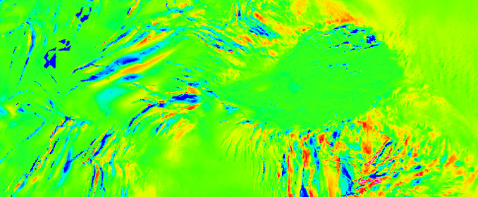
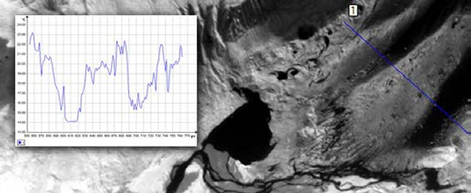
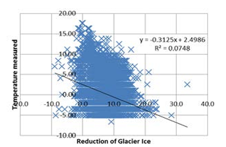
The data showed a reduction of the glacier surface of more than 6m between the two Lidar surveys. The thermal camera was used to identify the colder areas over the glacier and to highlight differences between the rock structures (measuring up to 30 degrees Celsius) and the ice surfaces (measuring between 15 and 18 degrees on warmer flight days, to -5 to +5 degrees Celsius on colder days) No strong correlation was found between the surface ice temperature and the change of the glacier surface. This is modified by movements of the Glacier up to 50m.
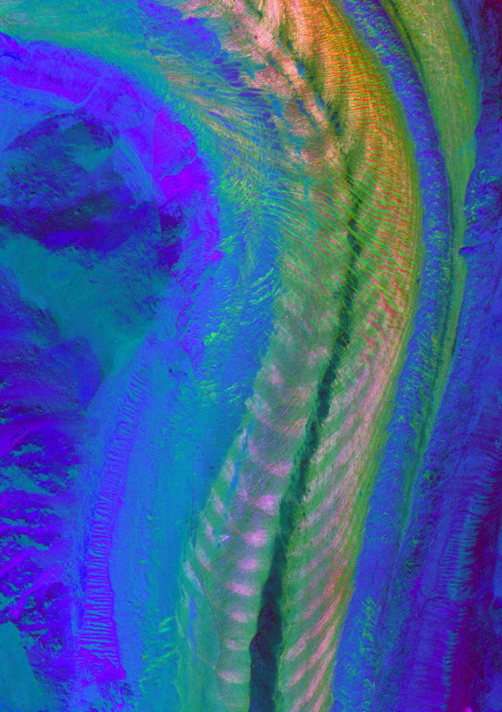
The hyperspectral data mapped out the structural components of the glacier extremely well. Ice density, along with surface dirt layers can be analyzed with greater detail to map their influence on glacier change, especially from the perspective of thermal signatures of the different ice types.
Dimap’s data, which will be further analyzed by the University of Conception – Chile, and will provide an important scientific base to understand the influence of changes on the ice surface and their emissivity on the reduction of glaciers. With mining operations around many glacier areas, this is a pressing point for environmental monitoring and the developed technology can be used for this purpose.


Change of Glacier Volume – comparison between two Lidar surveys, showing also the movement of major glacier structures.

Cross-section of the temperature measured over the glacier ice.

The analysis between the reduction of the Glacier and the measured temperatures.
Oblique picture of the Glacier Carlos, 4000m above sea level, Back Picture: Mapped out Glacier Structures using hyperspectral data.

